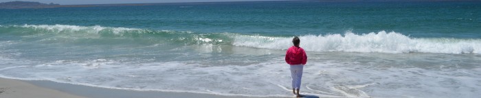
Anyone who travels a certain route begins to recognize certain things along the way, things that mark where you are in your drive, how far you have to go. It’s kind of a subtle thing where you suddenly notice something and are kind of amazed that you’ve missed it before and then it becomes something you look for. And you add to your collection of travel markers the more you drive that way.
For me, it’s been driving Highway 51 between Tulsa and Stillwater for the past couple of years. People are amazed that I prefer the old road to the turnpike – and the turnpike is fine – but I really like this old road, the same one I drove when I was in college with massive road improvements in the last 50 years, thank goodness. It was longer and more dangerous back then, more curves and curves and curves. Now it’s pretty much a straight shot from here to there and back again.
I call it my zen drive where I think and watch and look for new things along the way. Since I travel with my camera, I’ll stop and take a picture of something I want to remember (because that’s what I do). Here’s kind of a travelogue of the trip. There are some things I love that I can’t get photos of because there’s no place to stop or I haven’t stopped yet. But, you’ll get the picture.
When I leave Tulsa, I drive through beautiful historic neighborhoods before crossing the Arkansas River heading west. I’m now crossing over the railroad yards and into an industrial area. When I return, I get a wonderful view through oil refineries with trains running through and the skyline of Tulsa in the backdrop. It makes me realize how our city grew from its early days.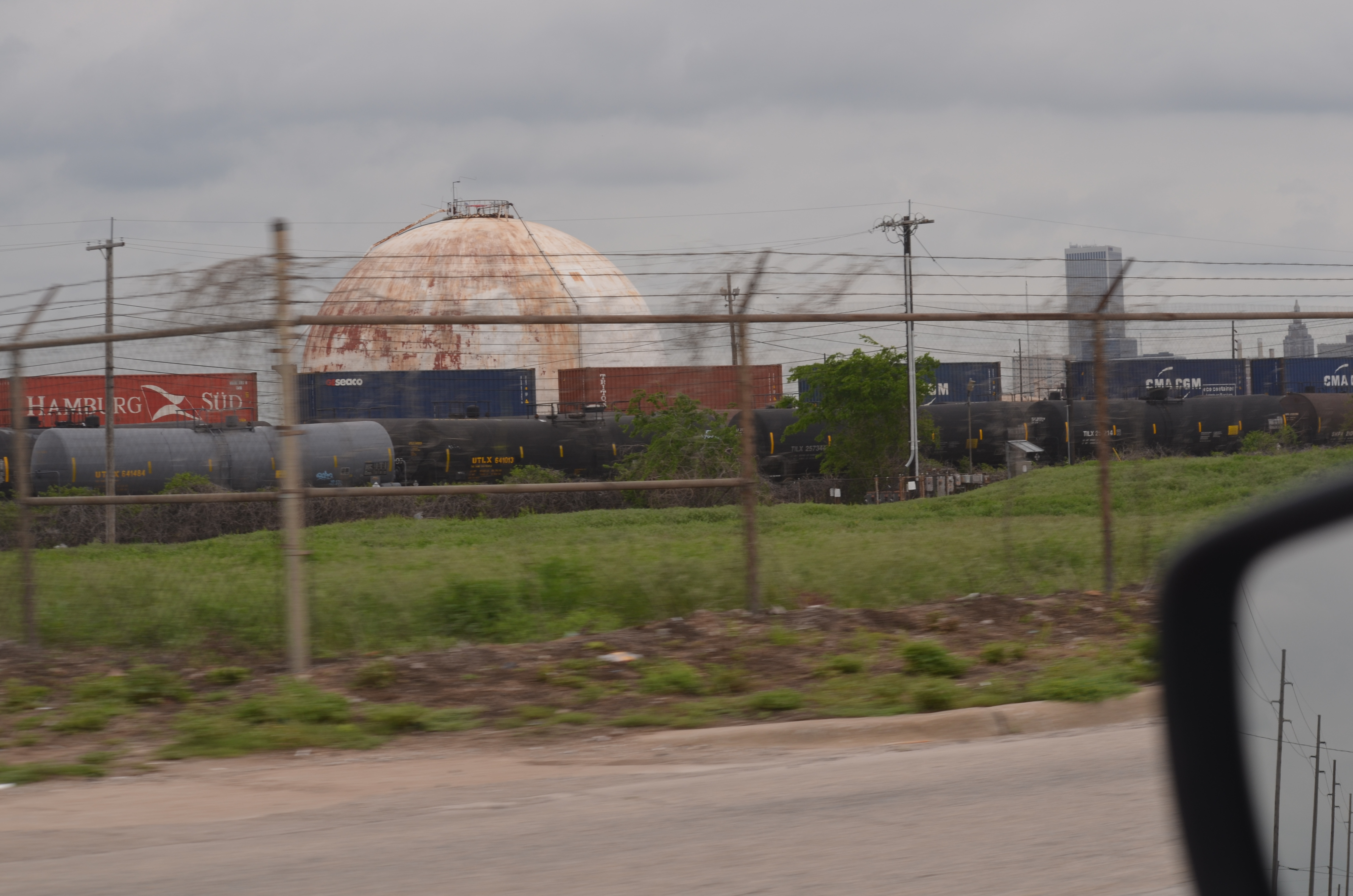 Here’s the view when I pull up the hill into Chandler Park and look back.
 I’m mixing pictures coming and going, so there are views from east and west. Bear with me.
Then, I turn onto Avery Road, which winds around under Chandler Park with the Arkansas River to the north of me. This is one of the most nostalgic pieces of the trip to me, although it’s curvy and narrow. No pictures of the drive because there are few places to stop, but you have views of the river in the winter and lush greenery in the summer. There are bluffs to admire as you drive under them and colors of fall and spring to enjoy. This is entering Avery Drive from the west side as I come home. There are more hairpin turns to come. As soon as I turn off of Avery Drive, I see one of my favorite landmarks, a memory of all the years I’ve driven this road. It’s the Monarch Cement…what is it? Pretty cool anyway. In the summer, it’s covered in greenery.
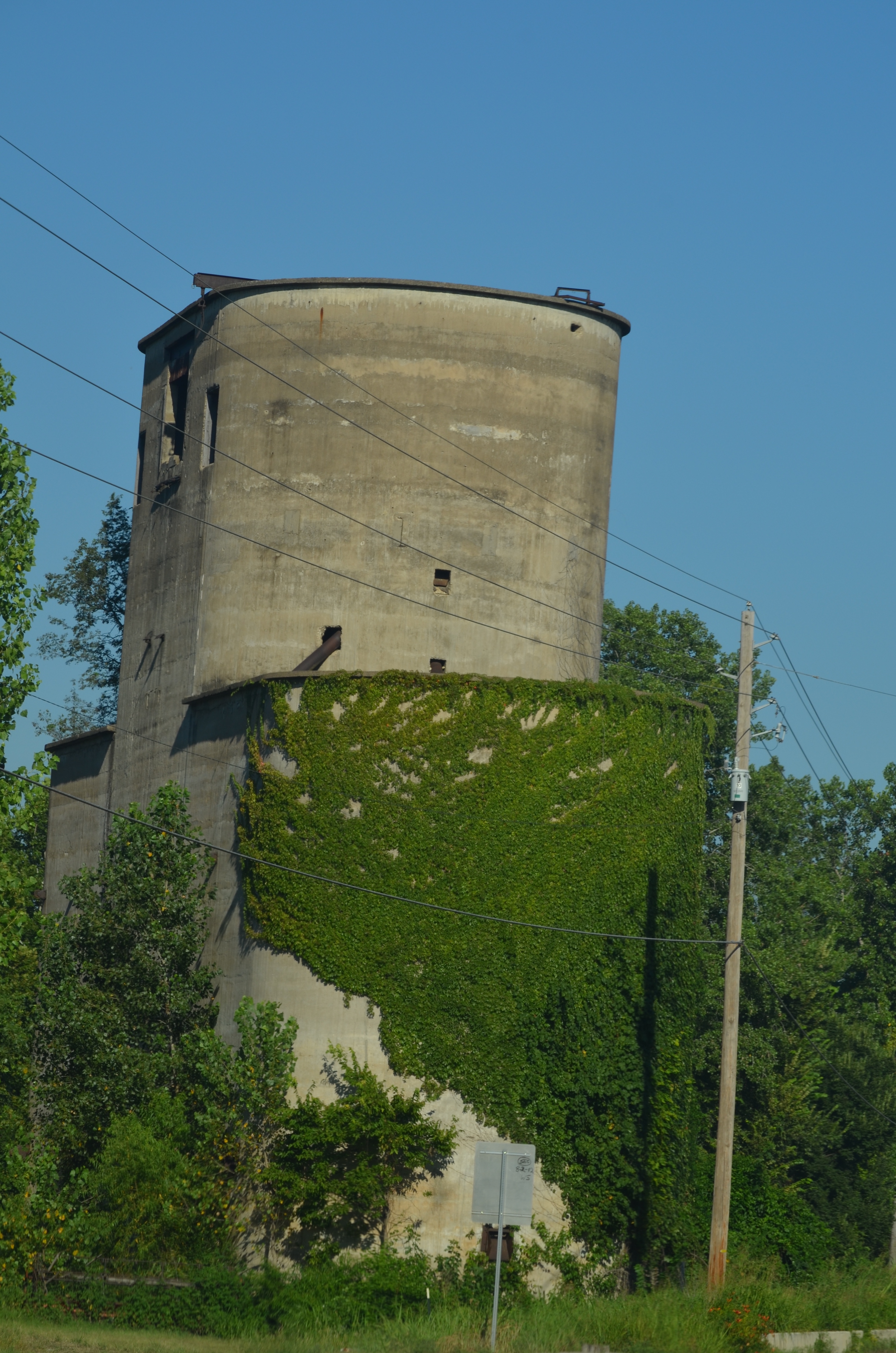 Coming from the west, you see it in full frontal, although I still can’t figure out all the words on it. Monarch Cement Co. ???? Dept. From the west, I can see it from miles away.
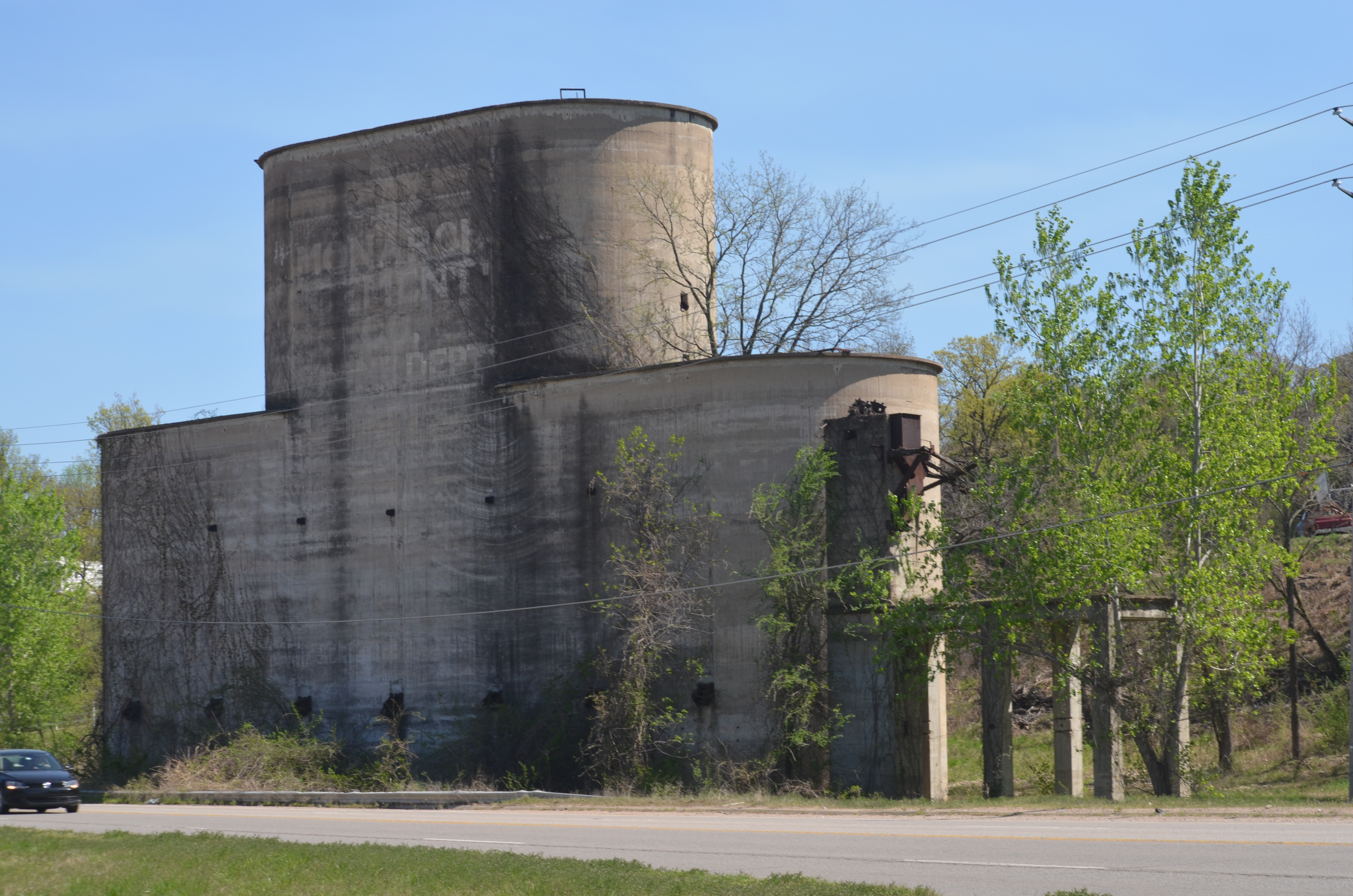 On the straight road past that, there is usually a train either parked or passing. Who doesn’t love seeing trains? I even love all the tags left by rogue artists decorating the train cars.
 Next, around the corner, is the little town of Lotsee. I’ve looked it up and it’s named after the owner’s daughter. The whole place is hardly more than a few lots long along the highway as you pass the Lotsee city limit signs on each side in about 15 seconds at 65 mph. From the west, you spot the big cow sign.
 I’ve actually stopped in to buy pecans and they have lots of varieties in the fall. It’s a 2,000 acre cattle and pecan ranch with horseback riding added called the Flying G Ranch. I don’t think Lotsee was there, but I met her husband, the only two official inhabitants of Lotsee, OK. They are Oklahoma State University people, so we had that in common.
Over the hills, past the Keystone dam, headed for Mannford, you cross over a small part of Lake Keystone and a quick view of the lake. That’s fun as you watch the weather on the water with either peaceful calm or windy whitecaps. Heading into Mannford, I’ve started looking over for this funny sign that I noticed when I stopped there once. Awesome!
Leaving Mannford, you head into areas where your cell phone service can go in and out as you drive through hills with breaks for views across the way. As you cross Cottonwood Creek, you can see an area that links to Keystone and is sometimes dry and sometimes swampy with rainfall. Somewhere along the way, you see this row of mailboxes for inhabitants you can’t see from the road. I also met these guys last week around that area. A couple of weeks before, some of them had escaped somewhere and I found myself passing three black cows as they ambled along the shoulder of the road.
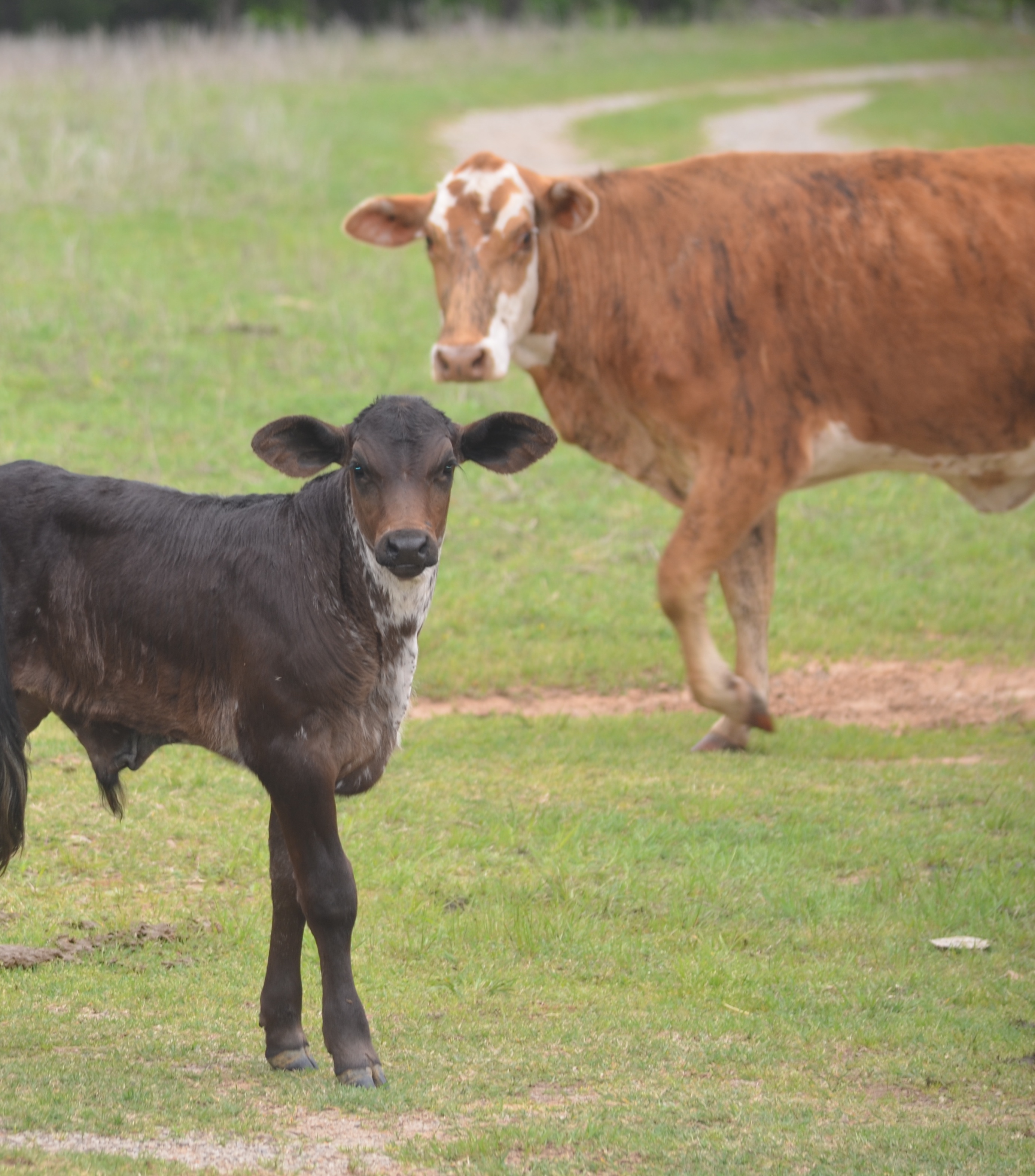 Then I cross the Cimarron River, which has the most beautiful view of bluffs, shadowed in the morning and glowing in afternoon light. I look both ways as I cross over. Cimarron reminds of the land run and the book and movie Cimarron and Oklahoma in general. Miles past this, the road rises and I can look to the south when I’m heading east and see where the river turns into the countryside.
 One of the great surprises of the drive came this winter when I noticed a herd by the side of the road and turned back to check it out. Sure enough, it was a herd of bison near the crossroads where you can turn towards Oilton. Now I check for it all the time, coming or going. Once I pulled over to watch them and a highway patrolman stopped to see if everything was ok. That was a nice feeling because he was thoughtfully checking on me and I told him I was just watching the bison. He may have thought that was a bit much, but I always find them interesting.
 This stretch of highway I drive is only about 65 miles and I see all kinds of animals. There are lots of cows, horses, sheep, goats, and even a llama. As I head towards Yale, OK, home of the great athlete Jim Thorpe,
This building as you come to Yale from the east is intriguing. The basketball goal with the old building is a story of some kind out here along the road. Coming into Yale, I always enjoy this place, whatever the weather. Peacefully falling down in its own time.
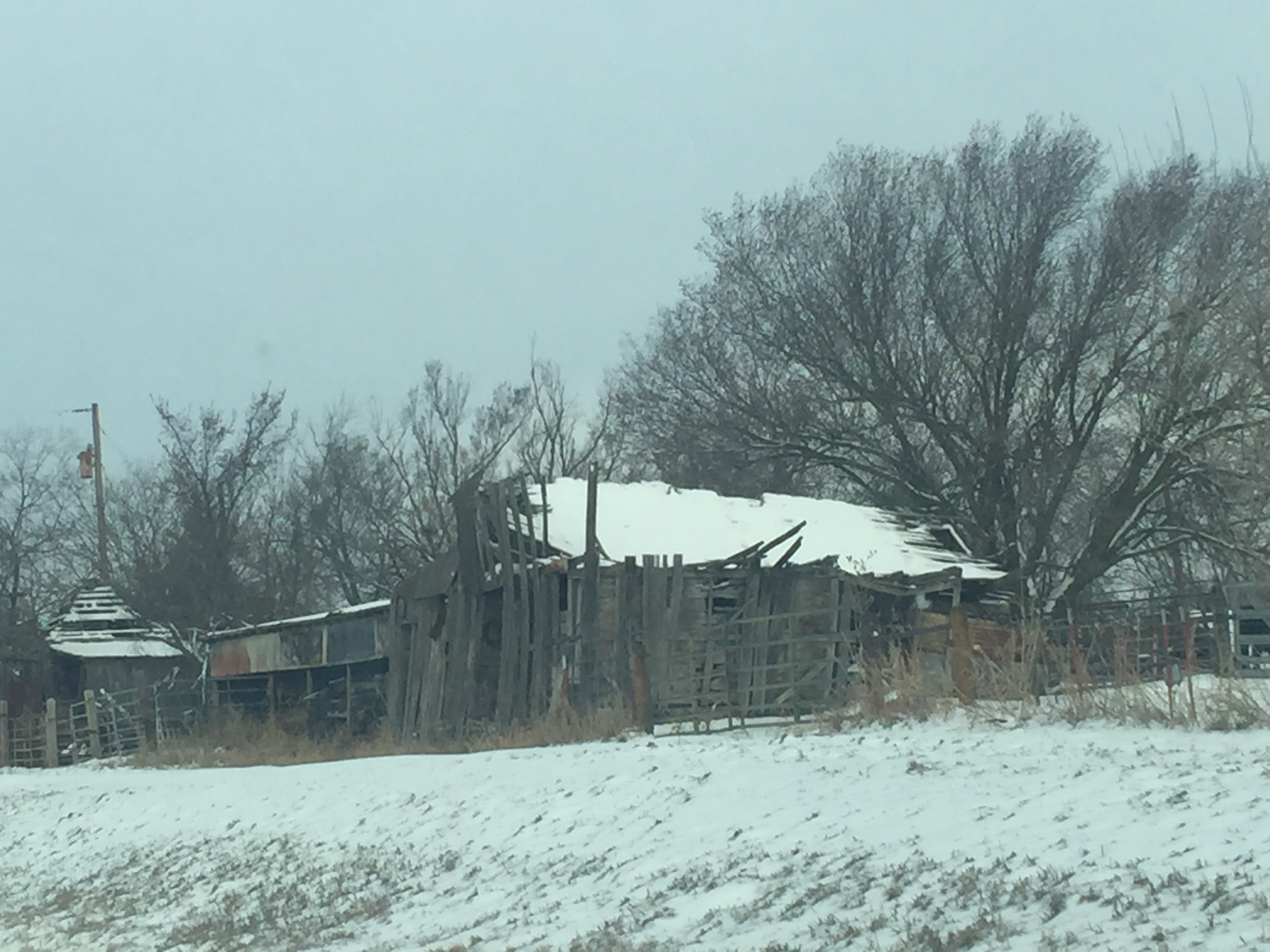 I slow down as I come into Yale because I know there is a watchful policeman there and I’ve been to their traffic court once (enough). Going slow, I noticed this patriotic painting.
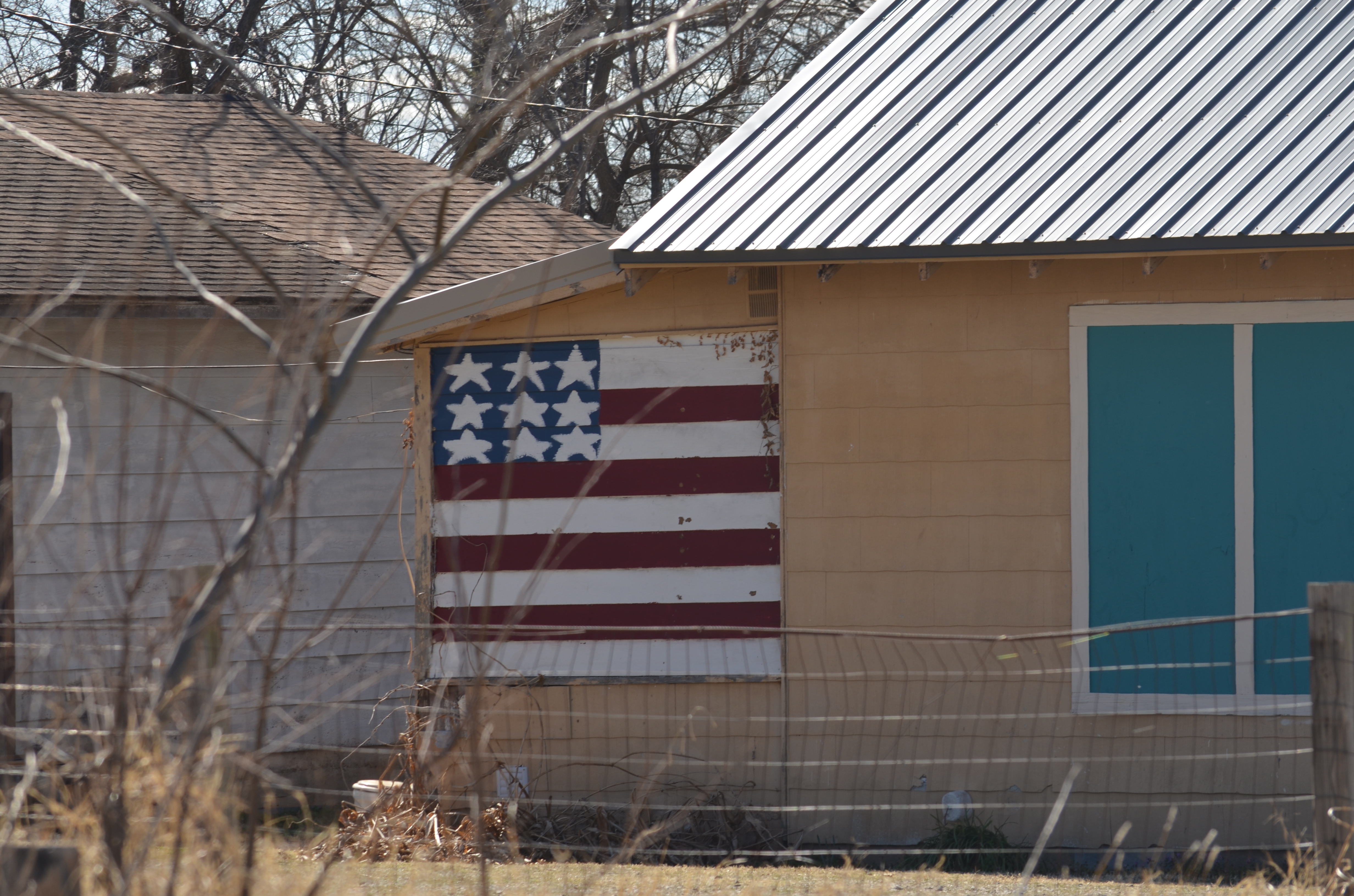 Leaving Yale, I cross Salt Creek and am always happy to see the herd of donkeys in a field. There have been adorable babies, but I haven’t caught a picture yet. How many animal herds have I mentioned in this relatively short drive? Not to mention chickens.
 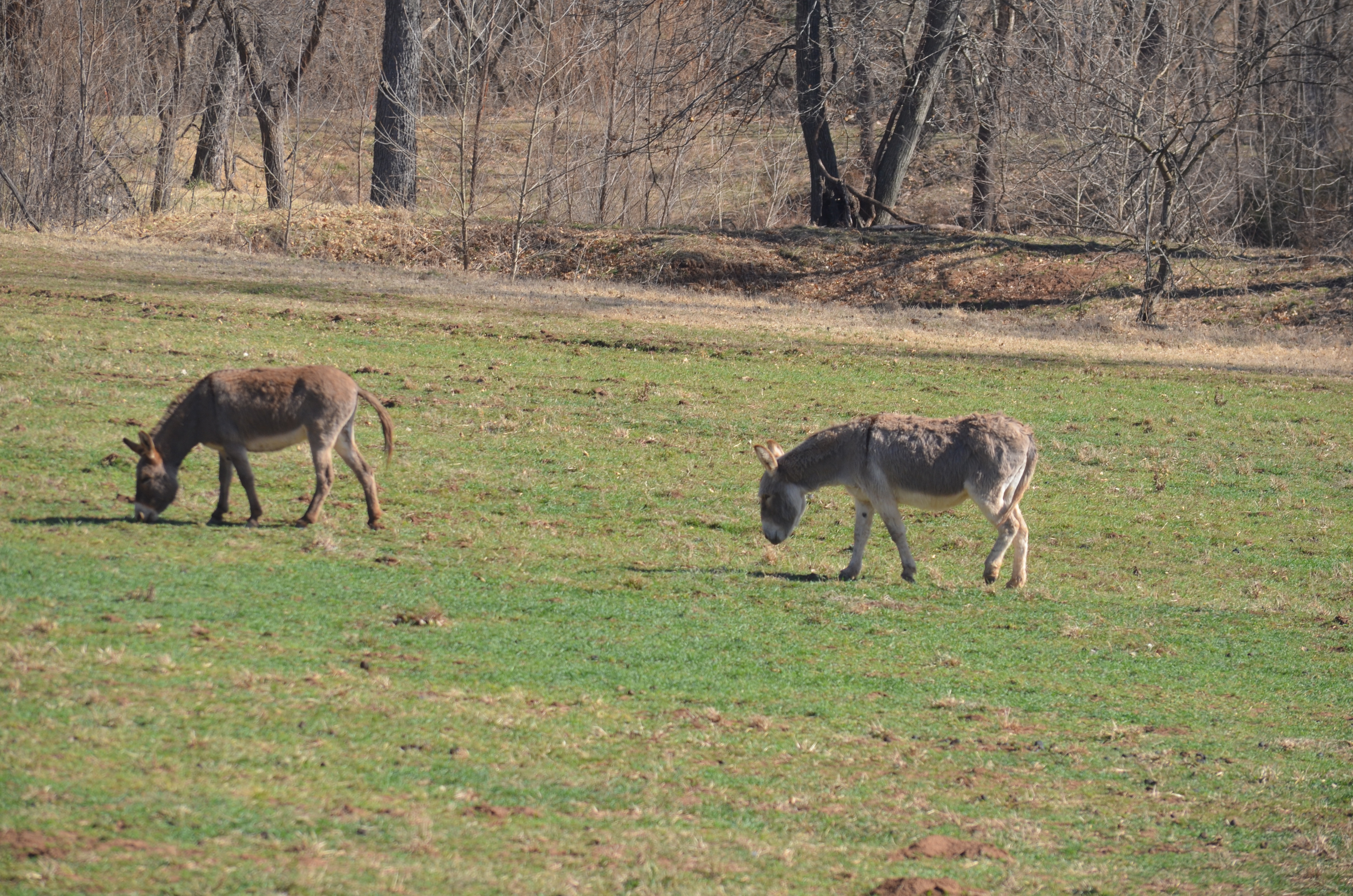 Past the Salt Creek Arena, I drive through woods where I once saw a deer step out in the early morning until I reach the intersection where my Sky Barn is seen best as you drive from west to east. I did a whole post on it.
 Past that are the archaeologically interesting Twin Mounds, where remnants of Civil War camps have been found. You only catch a glimpse of both of them coming from west to east. I learned about them when I stopped at the best little museum and antique shop ever, which is a couple of miles off of Highway 51 near Stillwater. I’ll have to write a whole post on this treasure of Oklahoma regional history.
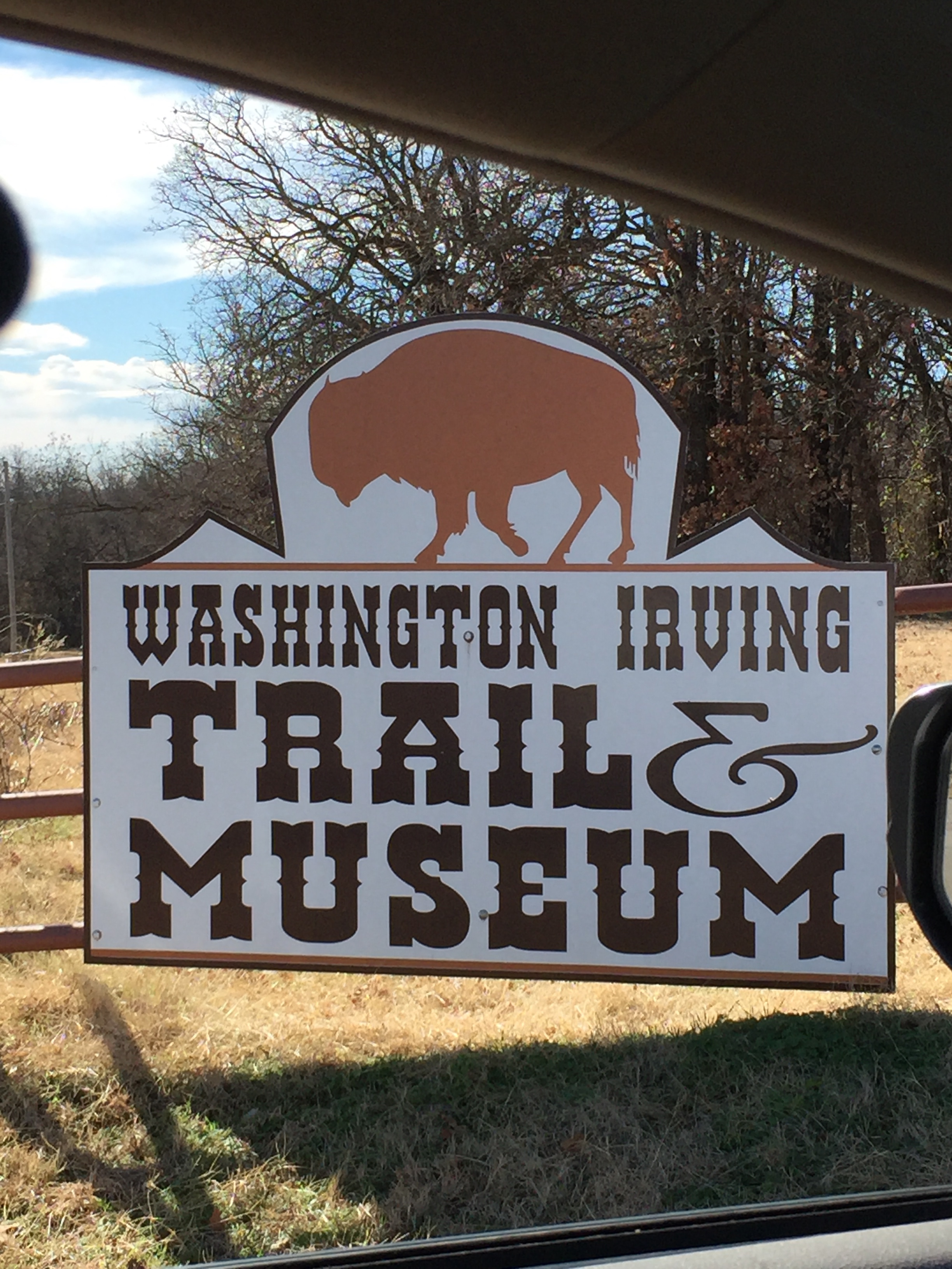 Next is one of the goat farms I pass.
  A new landmark for me is this field that I’ve passed so many times. Recently, I was driving on a clear day and the sky became hazy, smoky for no apparent reason. As I approached this place, the field had been burned in the few hours since I drove by in the morning. I’m hoping it was a controlled burn but it didn’t do much damage. Here is it is right after the burning.
 Within three days, I could barely tell it had burned for all the green. Amazing. About three weeks later, this same spot looks like this. Gotta love nature.
 When I pulled off to take this picture, I spotted a Scissortail Flycatcher, Oklahoma’s state bird, on the fence.
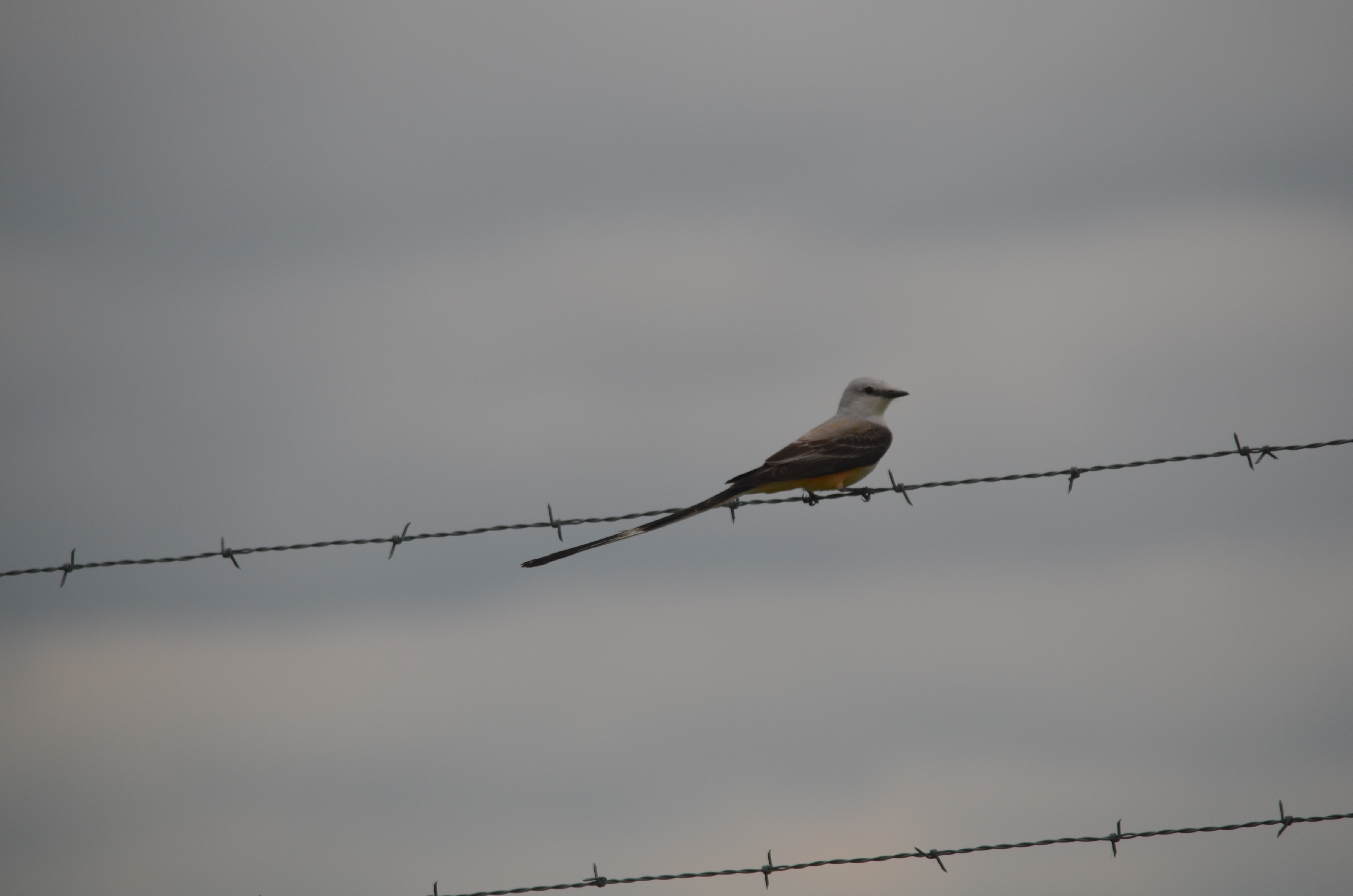 I now look for this house as I pass. I saw it once and couldn’t find it again for awhile. Now I know the landmarks to look for so I can nod as I pass. In the country, you don’t have to worry about taking down old houses and barns. Charming really.
On the final stretch into Stillwater, I pass a farm with several pumpjacks on Clay Road (my son’s name was Clay). I always look for this one to read the sign and smile. This week, the Indian Paintbrush is in bloom. Gorgeous.
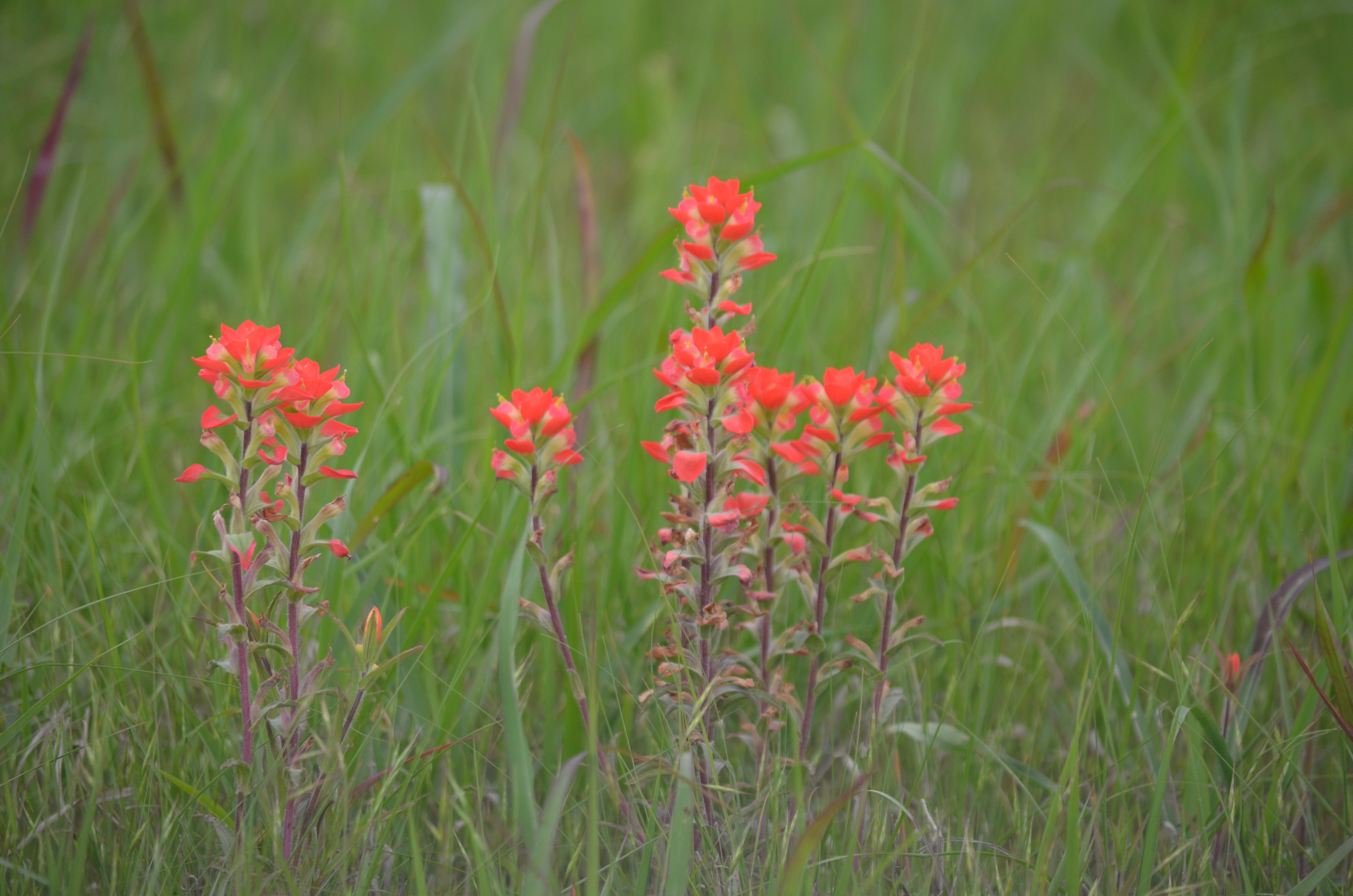
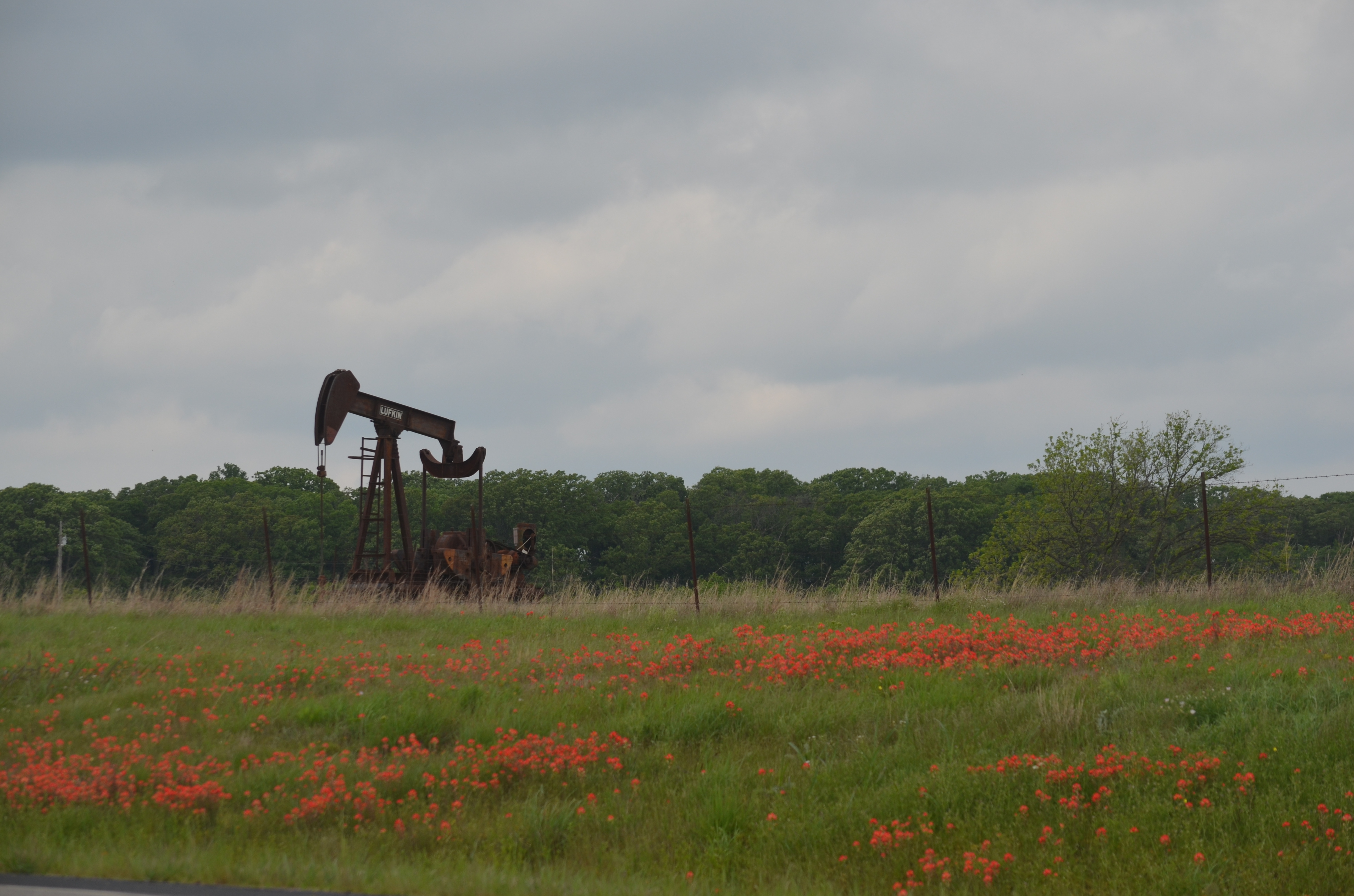 Sometime, I’ll do a post on the different pumpjacks, but this time I’ll just show you more Indian Paintbrush.
 Next is the road to historic Ingalls, location of one of the great western gunfights. I wrote a post about that awhile back.
And so my drive goes, never knowing who I will meet along the way… …driving into Stillwater where I pass this new exciting Transformer by the road…
 and see these familiar structures ahead.
  My final destination is Oklahoma State University with its beautiful campus, but this is the story of the road I take. I travel with beautiful sunrises…

 and sunsets…
 This trip reminds me to slow down and see all that is around me and notice something new every time. I travel from the city to the country to college town and back again. I drive through the Creek and Pawnee nations. I go from oil refineries and railroads to granaries and see the history of our state unfold before me. There are hills, woods, plains, fields and crops, farms, ranches, small towns, lakes and rivers, all changing with the season and the weather, different on cloudy days or different times of day when the slant of the light accents different objects and views. The skies are wide open and everything is there to remind me I’m alive and so glad to be here!
